View PDF
| Canmore ID |
39541 |
SCRAP ID |
2373 |
| Location OS Grid Ref: |
NR 85787 93476
|
Team |
Not in team
|
|
Existing Classifications
|
| Classification |
Period |
| CUP AND RING MARKED ROCK |
PREHISTORIC |
|
| Date Fieldwork Started |
23/07/2019 |
Date Fieldwork Completed |
|
| New Panel? |
No |
|
A1. Identifiers
| Panel Name |
KILMICHAEL GLASSARY |
Number |
1 |
| Other names |
|
| HER/SMR |
|
SM Number |
SM90184 |
Other |
PIC |
Classifications And Periods
| Classification 1 |
Cup And Ring Marked Rock |
Period 1 |
Neol/bronze Age |
County
ARGYLL
A2. Grid Reference(original find site)
| OS NGR |
NR |
85790 |
93490 |
| New OS NGR |
NR |
85787 |
93476 |
| Lat/Long |
56.08594 |
-5.44457 |
| Obtained By: |
GPS
|
A3. Current Location & Provenance
| Located |
|
| Accession no. |
Not given |
B1. Landscape Context
| Weather |
Cloudy
|
| Position in landscape |
Hillside |
| Topography(terrain within about 500m of panel.) |
Sloping |
| Aspect of slope (if on sloping terrain e.g. S, SE etc.) |
SE |
B2. Current land use & vegetation
B3. Forestry
B4. Archaeological Features within 200m / or visible from the panel
B5. Location Notes
Kilmichael Glassary 1 is located on the NW side of the village of Kilmichael Glassary, on a gentle, SE facing slope. The panel is located on the W side of a tributary road which leaves the main road through the village immediately N of the school. To the W of the panel is open rough grazing and to the S there is a street of houses; a cliff-edge is visible on higher slopes to the NW. As this site as a Historic Environment Scotland Property in Care, there is a metal fence enclosing the main site, which can be entered over a small style on the upper W side. Electric cables pass overhead, and c. 5m to the W, beyond the PIC area, is a second panel (Kilmichael Glassary 2; ScRAP ID: 3027 - this panel was previously also recorded under this Canmore ID but has been allocated it's own unique record as a part of the ScRAP.)
Previous Notes
NR89SE 1 8579 9349.
NR 858 934. A sheet of rock 25' x 15' x 0.1' is sculptured with over 80 cups, and 15 cups-and-one-ring, and keyhole figures. It is enclosed by a fence.
Twelve feet W of the SW corner of this fence, a rock area 9' x 2' bears six cups, some in groups, and one cup-and-ring (not under guardianship). Other outcrops in the vicinity have cup marks.
M Campbell and M Sandeman 1964; R W B Morris 1973.
NR 8579 9349. These two cup and ring marked rocks are generally as described.
Surveyed at 1:2500.
Visited by OS (DWR) 8 May 1973
No change to the report of above. No other cup marks were noted in this area, though there are many rock outcrops bearing natural weathering marks.
Visited by OS (BS) 10 February 1977
Situated in rough pasture to the NW of Am Baile Mor, Kilmichael Glassary, there are two groups of cup-and-ring markings (see also NR89SE 17).
This rock outcrop lies a short distance NW of the public road and is surrounded, in part, by iron railings. Within the fence the rock-face dips to the SE and two parallel terraces are profusely decorated with cups, rings and other motifs. Of particular note are four cups with keyhole-like rings, which occur on both the upper and lower terraces, and three large oval marks which lie on the W side of the lower terrace.
Outside the NW angle of the enclosure an extension of the rock-sheet has been exposed, revealing at least forty-seven plain cups and five cups with single rings (Campbell and Sandeman 1964).
RCAHMS 1988, visited June 1985.
A large area of rock has been cleared of turf to reveal an expanse of cup-markings, several of them unusually large. Many of the cups have grooves, while others are at least partly surrounded by an outer ring.
Information from ëExploring Scotlandís Heritage: Argyll and the Western Islesí, (1985).
C1. Panel Type
C2. Panel Dimensions, Slope & Orientation
Dimensions of panel (m to one decimal place)
| Length (longer axis) |
7.4 |
Width |
3.8 |
| Height (max) |
0.7 |
Height (min) |
0 |
Approximate slope of carved surface
Orientation (Aspect e.g. NW)
| Rock Surface |
SE |
Carved Surface |
E |
Carved Surface |
SE |
C3. Rock Surface
| Surface Compactness |
Friable
|
Grain Size |
Medium
|
Visible Anomalies |
No selection
|
Rock Type |
Schist
|
C4. Surface Features
- Fissures/cracks
- Natural Hollows
- Rough surface
C5. Panel Notes
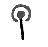
A large, exposed rectangular area of outcrop measuring 7.4m by 3.8m and up to 0.7m in height, which slopes gently to the SE at a roughly 20 degree angle. The rock is a friable, medium grain schist with numerous fissures, natural hollows and has - in places - a rough surface. The panel as been decorated with over 150 motifs, including 110 cup marks, 7 large cup marks, 2 dumbells, 5 cups with tails, 4 extended oval shaped motifs, 8 cups with partial rings, 1 cup with a tail and a partial ring enclosing the cup, 1 cup with a tail and a partial ring enclosing the cup and tail, 1 cup with a ring and tail from the cup to beyond the ring, a group of three cups enclosed by a ring, and three key hole shaped motifs: two of which are open at one end and the third of which is completely enclosed. There are also additional grooves, up to 5, which partially enclose a number of motifs on the lower E side of the panel.
C6. Probability
The probability that there is any rock art on the panel is
Definite
Comments
No comments added
C7. MOTIFS
Cup and Rings
|
|
1
|
Partial Ring

|
|
8
|
Groove

|
|
4
|
Keyhole

|
|
2
|
Other carvings and motifs

|
|
4
|
Visible Tool Marks? No
Visible Peck Marks? No
D1. Access
- Right to Roam access.
- Panel is on Private land.
- Access is managed by a national organisation.
D2. Awareness
- Panel was known before the project.
- This panel is known to others in the local community.
There are stories or folk traditions associated with this panel No
D3. Risk
Natural
- Large areas of the rock are covered in lichen, moss or algae.
- Water will pool deeply on parts of the surface.
Animal
Human
- The rock is located on/nearby a path or place where people might walk.
- The rock is in an area with visitor facilities.
Comments and other potential threats
No comments added


