View PDF
| Canmore ID |
370783 |
SCRAP ID |
3396 |
| Location OS Grid Ref: |
NT 57726 71487
|
Team |
Not in team
|
|
Existing Classifications
|
None.
|
| Date Fieldwork Started |
24/06/2020 |
Date Fieldwork Completed |
|
| New Panel? |
Yes |
|
A1. Identifiers
| Panel Name |
WHITELAW HILL |
Number |
|
| Other names |
Tanderlane |
| HER/SMR |
|
SM Number |
|
Other |
|
Classifications And Periods
| Classification 1 |
Cup And Ring Marked Stone |
Period 1 |
Neol/bronze Age |
County
EAST LOTHIAN
A2. Grid Reference(original find site)
| OS NGR |
|
|
|
| New OS NGR |
NT |
57726 |
71487 |
| Lat/Long |
55.93457 |
-2.67823 |
| Obtained By: |
GPS
Map
|
A3. Current Location & Provenance
| Located |
- Moved from original location
- Re-located
|
| Accession no. |
Not given |
B1. Landscape Context
| Weather |
Sunny
|
| Position in landscape |
Hillside |
| Topography(terrain within about 500m of panel.) |
Sloping |
| Aspect of slope (if on sloping terrain e.g. S, SE etc.) |
SSW |
B2. Current land use & vegetation
- Wood/Forest
- Arable
- Route way
B3. Forestry
B4. Archaeological Features within 200m / or visible from the panel
B5. Location Notes
The panel was originally situated on the SSW facing slope of Whitelaw Hill in an area with cropmarks showing linear features though to be a prehistoric enclosure (Canmore 56447). The grid reference gives it approximate position. It was moved from the arable field by farm machinery about 20 years ago and placed close to the edge of the farm track that runs down the hill towards Tanderlane Farm (about 100m to the S), about 20m from a small stream at the bottom of the hillside. The area to the W of the panel was planted with forestry about 20 years ago, which may have partially obscured the stone. It was discovered and brought to our attention by local resident Douglas Ledingham in May 2020, after the forestry had been felled. It was subsequently moved by the farmer to the garden of West Mains Farm, about 1km to the N. An application has been submitted to claim it as Treasure Trove and the outcome of this is pending.
C1. Panel Type
| In the landscape |
Boulder/Slab |
|
C2. Panel Dimensions, Slope & Orientation
Dimensions of panel (m to one decimal place)
| Length (longer axis) |
0.9 |
Width |
0.9 |
| Height (max) |
0.6 |
Height (min) |
0.4 |
Approximate slope of carved surface
Orientation (Aspect e.g. NW)
| Rock Surface |
N |
Carved Surface |
N |
Carved Surface |
|
C3. Rock Surface
| Surface Compactness |
Friable
|
Grain Size |
Fine
|
Visible Anomalies |
Not Visible
|
Rock Type |
Sandstone
|
C4. Surface Features
- Fissures/cracks
- Bedding Planes
C5. Panel Notes
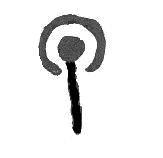
This is a roughly square sandstone boulder measuring 0.9x0.9m, with a sloping surface and steep sides, rising to a maximum height of 0.6m and minimum height of 0.4m. It has been moved from its original location and damaged by mechanical machinery at some point in the recent past, with a number parallel gouges on its higher edge. There are several faint fissures and eroding bedding planes on the surface, as well as numerous short incisions, probably plough marks on two sides and across the centre, suggesting that lay in an arable field for some time. The surface is covered in well-preserved motifs, most of which have unusually clear tool marks. The motifs include at least 15 cups, with an arrangement of 7 or 8 smaller cups in two parallel rows on the lower edge of the panel. In addition there are 4 cups with radials, one of which is very long, a dumbbell, 3 cups each with 2 penannulars and radials (one of these motifs has 2 radials), 2 cups with 1 penannular, 2 cups with partial rings (one of these also has a radial) and several long or branching grooves that flow down the sides of the panel. Some of the penannulars are very thin - just one line of peck marks - and there are also areas of more random but clear pecking, such as around the edges of one of the bedding planes. The level of preservation of the tool marks suggest that the panel has been covered for a considerable time, possibly within a burial monument or with its carved surface turned towards the ground.
C6. Probability
The probability that there is any rock art on the panel is
Definite
Comments
No comments added
C7. MOTIFS
Partial Ring

|
|
1
|
Groove

|
|
3
|
Visible Tool Marks? Yes
Visible Peck Marks? Yes
D1. Access
- Right to Roam access.
- Panel is on Private land.
D2. Awareness
- This panel is known to others in the local community.
There are stories or folk traditions associated with this panel No
D3. Risk
Natural
- There are trees nearby whose roots might disturb the rock.
Animal
Human
- The rock is within or on the edge of arable land.
- The rock is located on/nearby a path or place where people might walk.
- This panel has been estimated to be seriously at risk of being damaged or destroyed.
Comments and other potential threats
The panel is in a vulnerable position beside a farm track and on the edge of land that may be developed in the immediate future. It has been damaged recently by mechanical machinery in the process of moving it. Also, the motifs and tool marks are very clear but will soon start to erode now that they are exposed.