View PDF
| Canmore ID |
351657 |
SCRAP ID |
973 |
| Location OS Grid Ref: |
NH 51985 61051
|
Team |
Not in team
|
|
Existing Classifications
|
| Classification |
Period |
| CUP AND RING MARKED STONE |
PREHISTORIC |
|
| Date Fieldwork Started |
08/07/2019 |
Date Fieldwork Completed |
|
| New Panel? |
No |
|
A1. Identifiers
| Panel Name |
HEIGHTS OF FODDERTY |
Number |
|
| Other names |
|
| HER/SMR |
|
SM Number |
|
Other |
|
Classifications And Periods
| Classification 1 |
Cup And Ring Marked Stone |
Period 1 |
Neol/bronze Age |
County
ROSS AND CROMARTY
A2. Grid Reference(original find site)
| OS NGR |
NH |
51060 |
60714 |
| New OS NGR |
NH |
51985 |
61051 |
| Lat/Long |
57.61507 |
-4.47947 |
| Obtained By: |
GPS
Mobile Phone
|
A3. Current Location & Provenance
| Located |
- Moved from original location
- Re-located
- Provenance unknown
|
| Accession no. |
Not given |
B1. Landscape Context
| Weather |
Sunny
|
| Position in landscape |
|
| Topography(terrain within about 500m of panel.) |
|
| Aspect of slope (if on sloping terrain e.g. S, SE etc.) |
|
B2. Current land use & vegetation
B3. Forestry
B4. Archaeological Features within 200m / or visible from the panel
B5. Location Notes
This panel is displayed at the Neil Gunn Viewpoint, Heights of Brae. There is car parking and an interpretation board. It was moved there for safekeeping on 16 January 2014 from NH 5106 6071. It has previously been recorded as Clash Vaan ScRAP 1349 Canmore 351657 (at its old location), and HEIGHTS OF BRAE, NEIL GUNN VIEWPOINT ScRAP 2234 Canmore 350592 (at its new location).
Previous Notes
NH 51060 60714 A cup- and ring-marked stone was drawn to the attention of the Archaeology Scotland Adopt-a-Monument (AaM) team by concerned local residents. The stone was located within a proposed house plot, which had received full planning permission in 2006. While a condition had been attached to the planning permission, to protect the stone in situ, local residents noticed that the stone had been disturbed and became concerned about its future. Local residents with assistance from the AaM team recorded the original site of the stone, gained permission for the stone to be moved and relocated the stone to the Neil Gunn Memorial site.
The stone measured 0.8 x 0.7 x 0.3m and was weathered to the point that although the cup marks were fairly visible the rings were only faintly visible. Interpretation information was provided and the stone now forms part of a wider heritage trail, which has improved access to the monument. This work was undertaken, 1 January 2012 ñ 25 March 2014, as part of the 2011ñ16 Adopt-a-Monument Scheme.
Archive and report: Archaeology Scotland
Funder: Adopt-a-Monument Leader Fund, Strathpeffer Initiative, Neil Gunn Trust, Heritage Lottery Fund and Highland Leader Fund 2007ñ13
John Wombell and Susan Kruse ñ Neil Gunn Memorial Trust
(Source: DES)
C1. Panel Type
| In the landscape |
Boulder/Slab |
|
C2. Panel Dimensions, Slope & Orientation
Dimensions of panel (m to one decimal place)
| Length (longer axis) |
0.9 |
Width |
0.8 |
| Height (max) |
0.4 |
Height (min) |
0 |
Approximate slope of carved surface
Orientation (Aspect e.g. NW)
| Rock Surface |
|
Carved Surface |
W |
Carved Surface |
E |
C3. Rock Surface
| Surface Compactness |
Hard
|
Grain Size |
Medium
|
Visible Anomalies |
No selection
|
Rock Type |
Schist
|
C4. Surface Features
- Fissures/cracks
- Rough surface
C5. Panel Notes
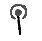
The panel is a slightly flattened boulder of schist, 0.9m x 0.8m x 0.4m thick. There are motifs on both sides. When the panel was reset in 2014 it was mounted against a low wall, upright in a N-S plane, so that the motifs on each side could be seen.
On the side now facing W, the flatter surface, there are 17 cups, of which 3 have definite rings, 1 has a penannular, 1 has a possible partial ring, and 1 has an arc. One of the ringed cups has a second ring, and is aligned with the two other ringed cups, and joined to them by a long groove that connects all the central cups within these 3 motifs. The cup with pennanular is joined to an adjacent cup by a groove.
The side facing E is more domed and the motifs are larger and deeper than on the W face. There are 18 mainly deep cups, of which 1 has a clear ring and one has a partial ring. At least 3 of the cups are conjoined or elongated. There is a groove around 2 of the upper cups.
C6. Probability
The probability that there is any rock art on the panel is
Definite
Comments
No comments added
C7. MOTIFS
Partial Ring

|

|
|
1
|
2
|
Radial

|
|
1
|
Groove

|
|
1
|
Visible Tool Marks? No
Visible Peck Marks? No
D1. Access
- Right to Roam access.
- There is and interpretation on site.
D2. Awareness
- Panel was known before the project.
- This panel is known to others in the local community.
There are stories or folk traditions associated with this panel No
D3. Risk
Natural
Animal
Human
- The rock is located on/nearby a path or place where people might walk.
- The rock is in an area with visitor facilities.
Comments and other potential threats
No comments added